Commissioned by: Addis Ababa City Administration (2017)
Context & Challenge
In 2017, Addis Ababa launched a bold strategy to house its growing population while addressing the challenges of informal settlements and peripheral urban sprawl. The Nefas Silk site 01_04, located in Kersa Kontema near the boundary of Nifas Silk and Akaki Kality sub-cities, was selected for this strategic intervention.
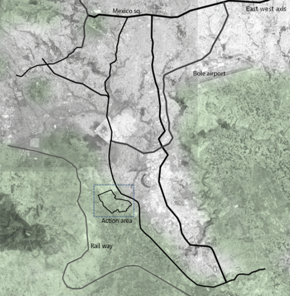
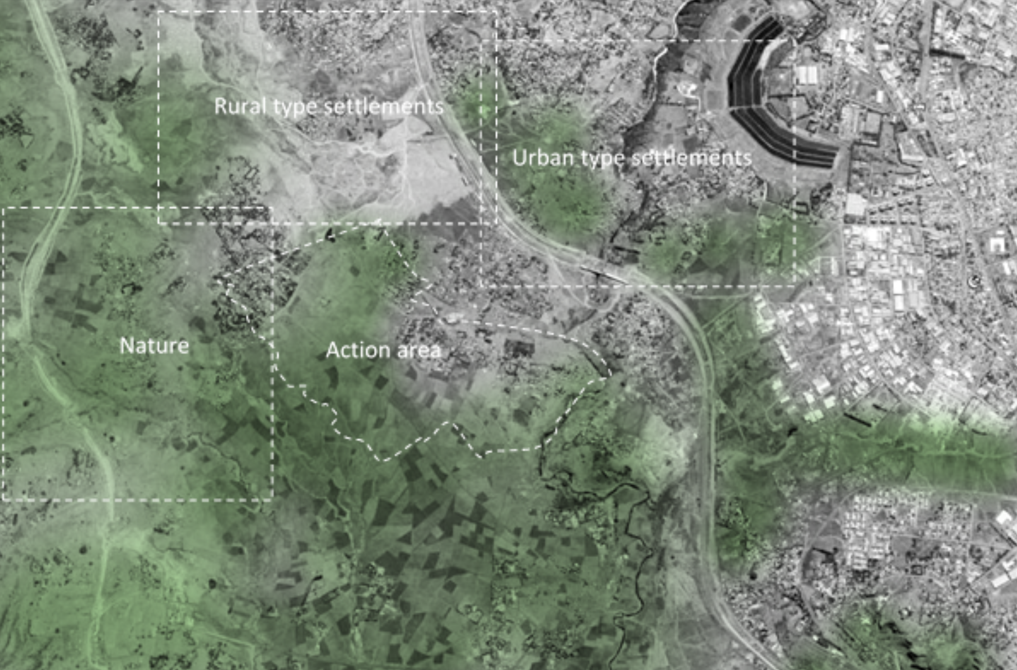
The 196-hectare site, largely open land with scattered rural dwellings and quarry sites, lies at the southwestern fringe of the city, 15 km from Mexico Square and linked by arterial roads and a nearby railway. This development forms part of the national effort to deploy vertical housing (condominiums) as a tool for land efficiency and economic integration.

Spatial Diagnosis
Natural and Urban Morphology
- Steady slope (98% under 15%) made the site suitable for vertical development.
- The presence of seasonal streams and quarry-induced topography offered constraints and potential for creative land use zoning.
- Dispersed rural housing typologies dominated the north and southeast zones.
Infrastructure Gaps
- Sparse footpaths, cul-de-sacs, and poor connectivity.
- Lack of drainage, road hierarchy, and basic social services.
Environmental Context
- High-tension lines, wind exposure from the east (Kality treatment plant), and dust from quarry operations are flagged as health and planning risks.

Socioeconomic Findings
- Low housing standards: 95% of homes were built with mud and wood, most lacking private kitchens or toilets.
- Substandard infrastructure: Poor water, power, and waste services.
- Employment: Predominantly laborers and informal traders. 42% live under $1.60/day.
- Social fabric: 82% engaged in local IDIRs; strong savings propensity (67%).
Strategic Vision
“To create a self-contained, dense, safe, and integrated condominium-based urban neighborhood.”
Design Principles & Responses
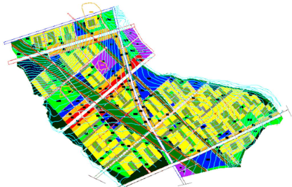
- Land Use Mix: 33% residential, balanced by administrative, commercial, and service functions along key corridors.
- Street Hierarchy: Two major arterial connectors plus an internal street grid supporting walkability and transport.
- Green Infrastructure: Buffer zones along high-tension lines and quarry sites converted into parks.
- Community Anchors: 5 KGs, 1 primary, 1 secondary school, 4 health centers, open and closed market spaces.
- Manufacturing: Small-scale non-polluting industries are located at the southern and northeastern edges.
Role & Involvement
As a planning team member, I supported:
- Urban diagnosis and environmental constraint analysis
- Community surveying and physical audits
- Neighbourhood design proposals and LDP document drafting
- Stakeholder coordination and in-house presentations
Reflection
The Nefas Silk LDP was a strategic testbed: Could we turn underused fringe land into a structured, livable urban fabric while respecting socioeconomic fragility? It wasn’t just a design project—it was a policy implementation vehicle.
Brook Abebe
Urbanist. Strategist. Educator.
For inquiries or collaboration: [contact]